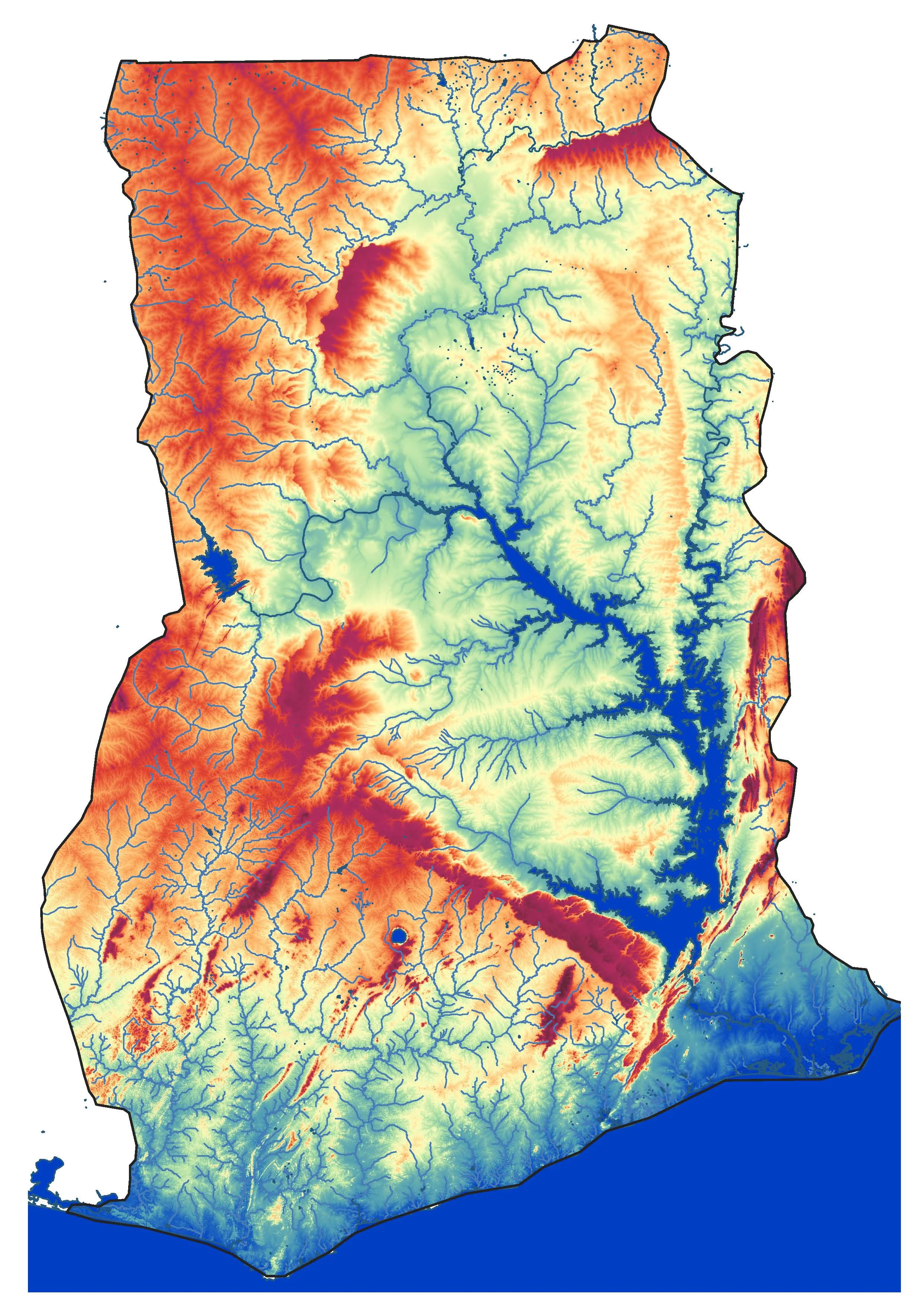
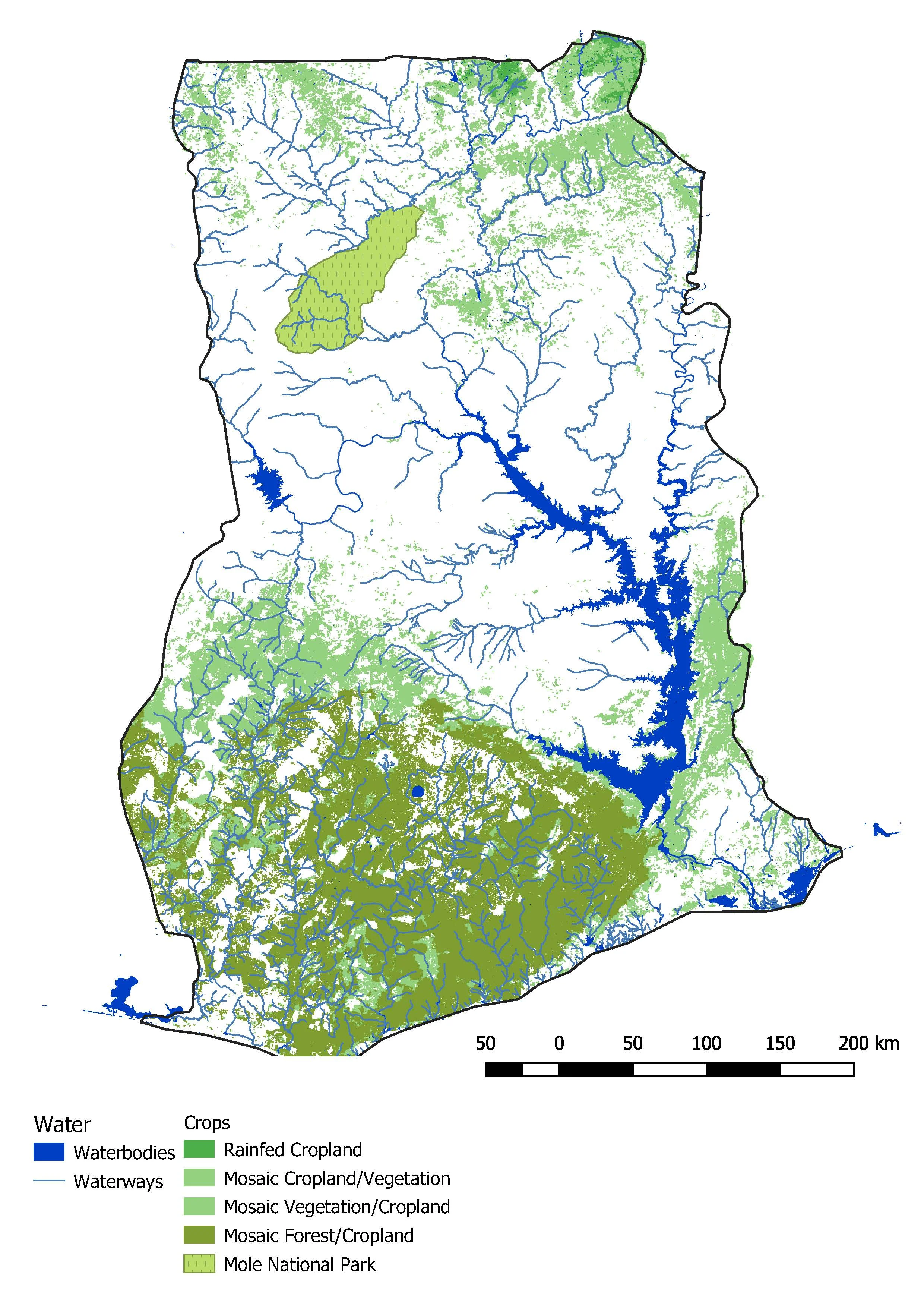
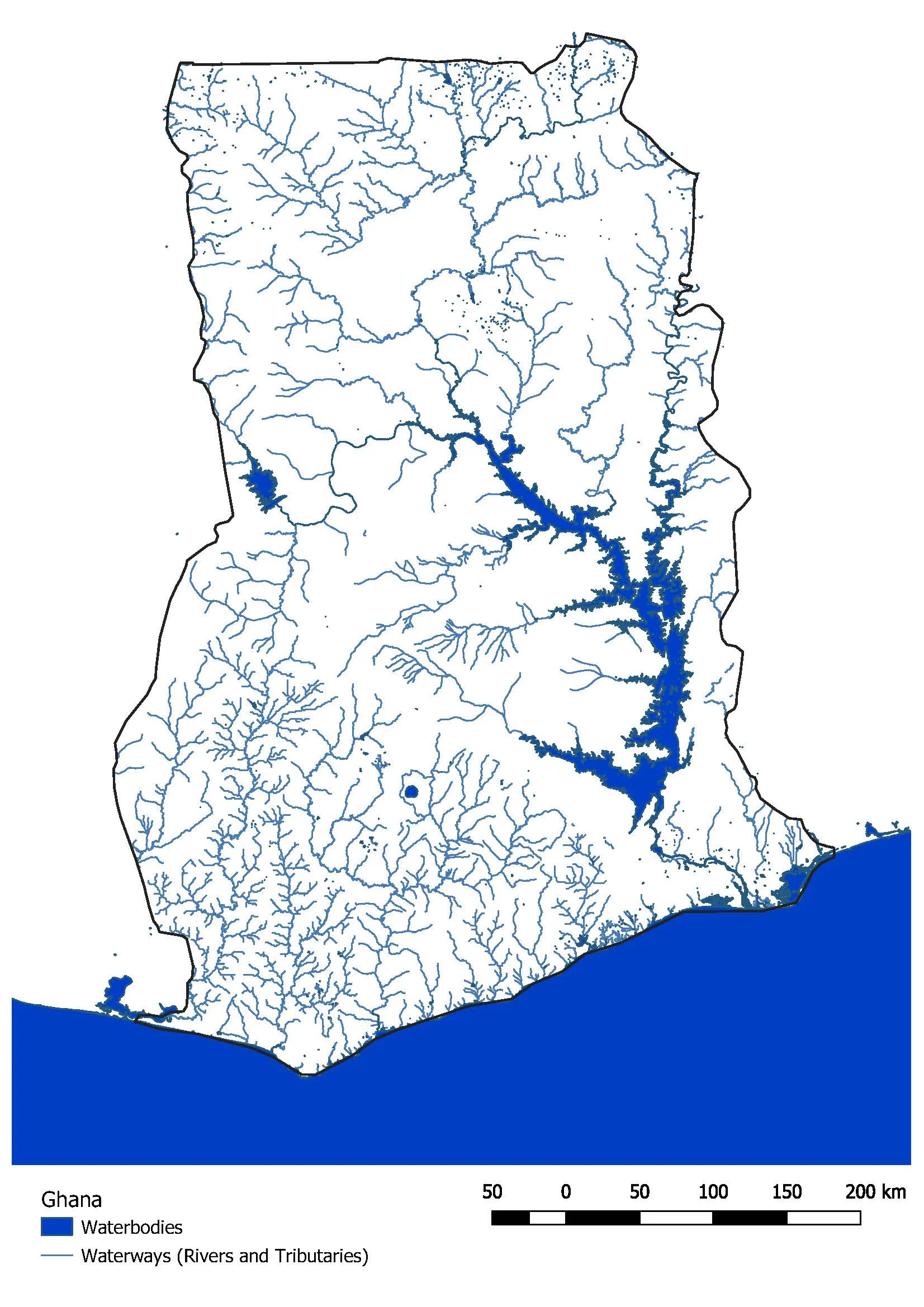
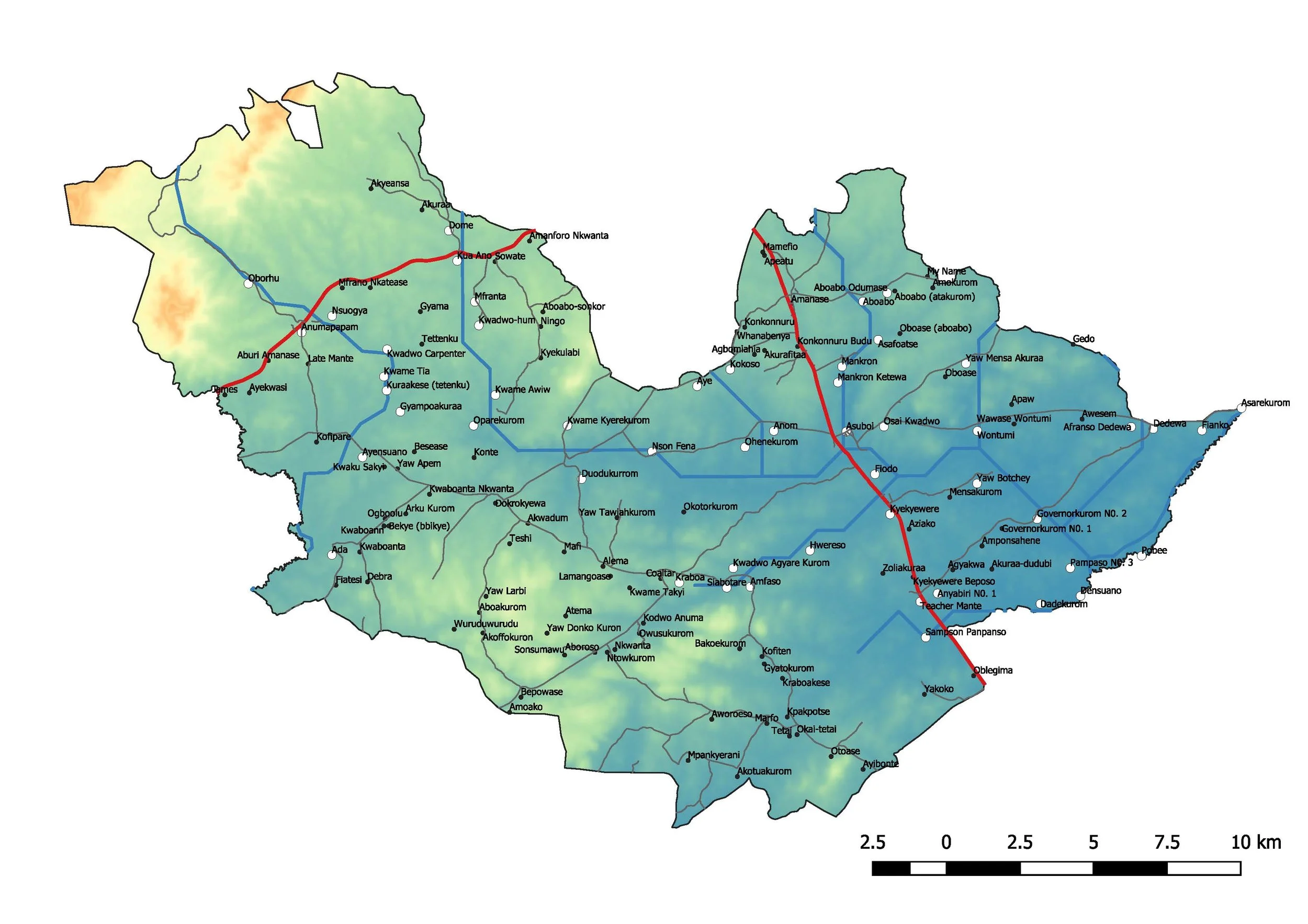
Mapping Surface Water Irrigation Potential in Ghana
With Burro Brand LLC
August 2018, MIT MISTI
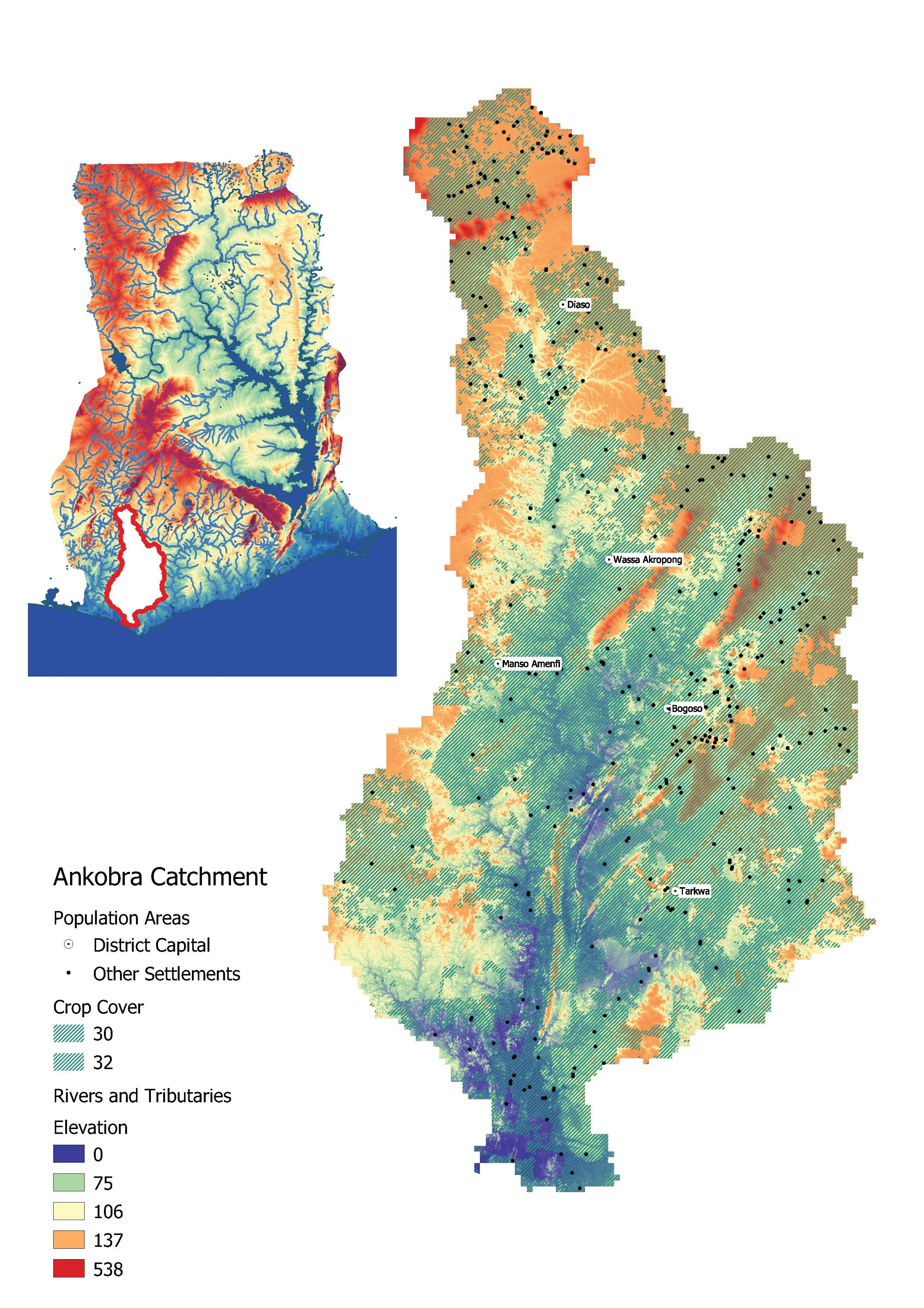
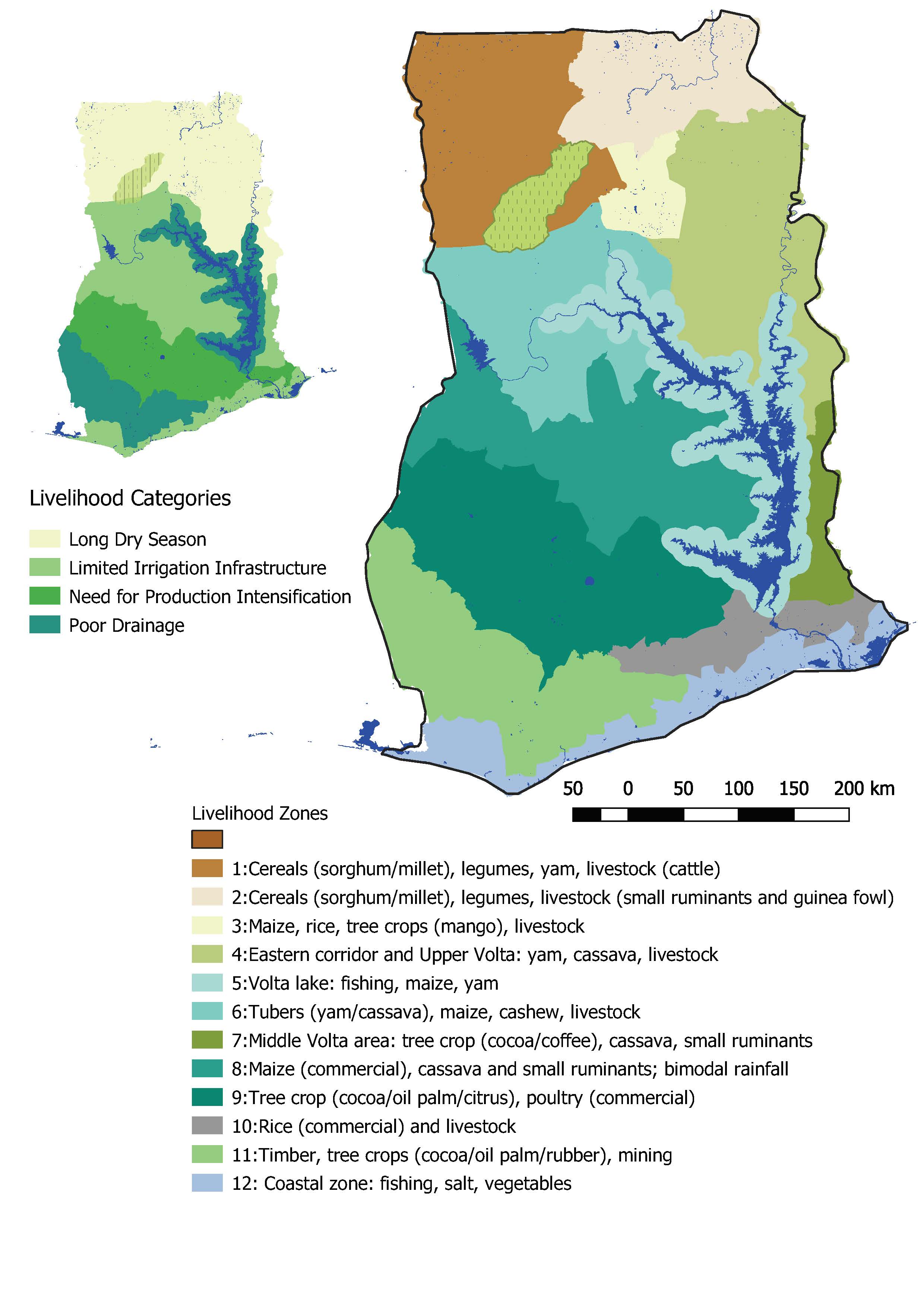
Developed a spatial methodology for predicting proximity to surface water as part of market research for Burro’s irrigation projects for small-scale farmers in Ghana using QGIS. Wrote tutorials and taught Burro staff on how to use GIS for their own projects. Developed a methodology for improving in-field data collection as part of relational data base management with their sales database.


Relocation Suitability Index
Fall 2017
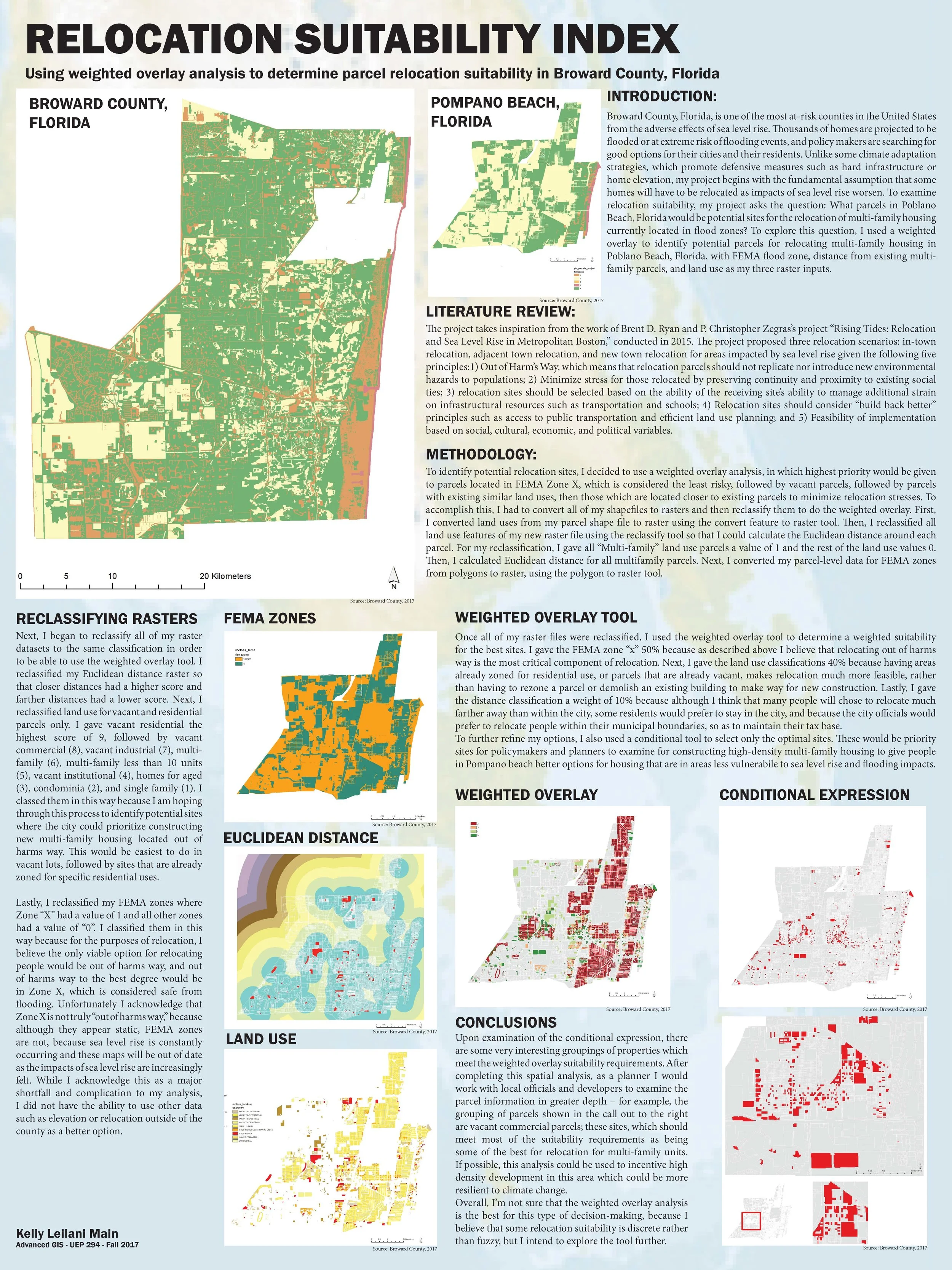
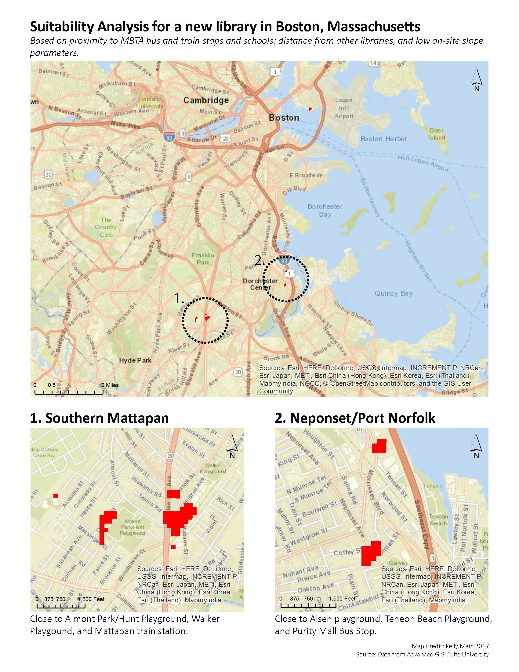
Broward County, Florida, is one of the most at-risk counties in the United States from the adverse effects of sea level rise. Thousands of homes are projected to be flooded or at extreme risk of flooding events, and policy makers are searching for good options for their cities and their residents. Unlike some climate adaptation strategies, which promote defensive measures such as hard infrastructure or home elevation, my project begins with the fundamental assumption that some homes will have to be relocated as impacts of sea level rise worsen. To examine relocation suitability, my project asks the question: What parcels in Poblano Beach, Florida would be potential sites for the relocation of multi-family housing currently located in flood zones? To explore this question, I used a weighted overlay to identify potential parcels for relocating multi-family housing in Poblano Beach, Florida, with FEMA flood zone, distance from existing multifamily parcels, and land use as my three raster inputs.
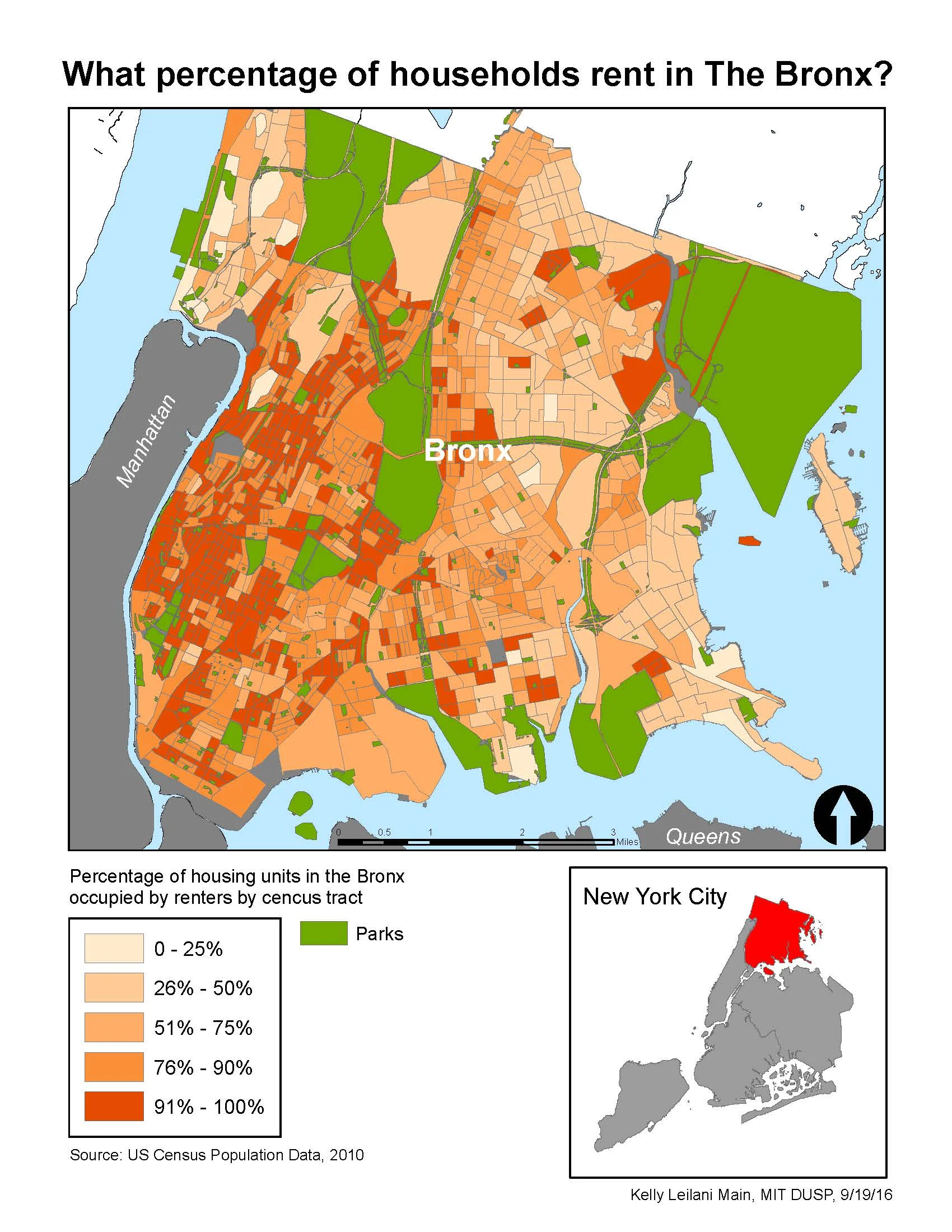
Other Work